New York: Use of drones increases for county government
Published: Sat, 06/10/23
Use of drones increases for county government
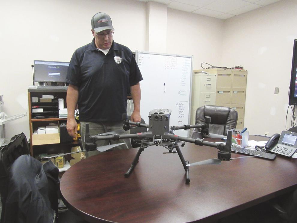
Delaware County Emergency Services Director Steve Hood stands behind one of the county’s two drones Wednesday, June 7 at the Emergency Services office in Delhi.
Vicky Klukkert | The Daily Star
The Daily Star
By Vicky Klukkert, Staff Writer
Finding hot spots during wildfires, inspecting streams and infrastructure and searching for a missing person are some of the projects drones help Delaware County personnel do.
Last week, a drone from a neighboring fire district was called to Hancock to fly above a wildfire to find the best way to fight the fire, Delaware County Emergency Services Director Steve Hood said. “It was very steep terrain,” he said. The drone was used for the management of the fire “rather than putting firefighters at risk,” he said.
The drone program in Delaware County has been in place for five years, county Planning Department Director Shelly Johnson-Bennett said. The county planning, sheriff’s office, emergency services, economic development and department of public works shared one drone for their different projects.
The drone was used by the EMS for search and rescue “a handful of times,” she said. Economic development used it for site layouts for potential businesses. The drone was flown over the former county Poor House Cemetery as part of a preservation project. It was flown over several land parcels “to evaluate the criteria for acquisition of lands for New York City buyouts,” she said. “We have flown flood-prone areas during high water events including ice jams in the winter, the Christmas flood of 2020 and the areas below the impoundments when there are high volume releases.”
The DPW used the drone to fly over bridges and map the flights for design purposes. “We do periodic flights at the solid waste management facility to identify hot spots,” she said. The drone also was used for stream projects, mapping out parks and trails, and documenting the progress at the Behavioral Health and DPW construction sites.
The county’s drone was damaged in a crash and the county used the insurance money and money from the budget to purchase a new drone for the planning department, Hood said. The county also approved spending American Rescue Plan Act funds to buy a second drone for the sheriff’s and emergency services departments.
Hood said there are about eight pilots for the two drones. Because a municipality owns the drones, each employee who wants to fly the drone must pass a pilot’s license test issued by the Federal Aviation Administration and the county must adhere to other FAA rules. The pilots will go through a four-day training session next month by Steel City Drones to learn about every aspect of the drone, including how to update its software, how to fly it and program flight-plan routes into it, he said.
The drone for the emergency services department is equipped with an infrared camera and a thermal imaging camera, which pick up different heat signatures, Hood said. “The camera has a high definition 4k optical zoom lens that takes incredible photos,” he said. The drones will be used during natural disasters, for searches and during fire investigations. “Overhead imaging will help investigations,” he said.
The drone for the planning department “has the standard zoom and infrared cameras as well as a Lidar camera and a digital mapping camera for 3-D imaging and mapping,” Johnson-Bennett said. “The new cameras will allow for versatility when flying infrastructure so that survey quality mapping can be generated and design quality modeling can be done to assist with bridge design, site development and other applications for land management and project reviews.”
Johnson-Bennett said the drone program will expand the county’s “capacity to protect the health and welfare of our residents, provide a way to encourage sound land use practices, reduce design costs for public projects and creates a platform for public information.”